After completing the AT in 2005, I was hired to my first office job and I made it 10 months before needing to break free from the cubical. I also needed to lose the 20 pounds I had put on sitting in said cubical.
In some respects I was lucky, because at least my desk was positioned near a window where I could look out at nature, but instead of providing inspiration it made me feel trapped. Fortunately my job had a four-month slow season that coincided with the optimal PCT thru hiking months, and when I asked my boss for time off, she gave it to me.
Since finishing the Appalachian Trail in 2005, not a day passed that I didn’t miss the trail. I missed the friends I made, the animals I saw, the time to think, the way my body felt at the end of a long day. But to go straight from my experience on the AT to hiking out west was still a bit of a stretch. The thought of walking through the mojave desert with 30-miles between water stops terrified me; and I had to Google the definitions of an ‘ice axe’ and ‘crampons.’ But I knew that I could physically hike 2,000+ miles and I knew that I wanted another adventure, so fueled by youthful naivete I flew out to California in early May, 2006 to begin my journey.

Mt Whitney
The trail started on the US/Mexico border. It was unnerving to see border patrol cars and campgrounds scattered throughout the dessert, but the littered shoes, food wrappers and clothes left behind by immigrants proved more disconcerting. It was hard enough to travel this terrain as a prepared hiker, I can’t imagine fleeing through the barren landscape with meager rations, hiking for my life and livelihood!
I struggled with the weight of my pack in the dessert. I would have to carry 2+ gallons of water, and water is SUPER heavy. But when it came to dealing with the heat and direct sunlight I found myself far better equipped than other hikers. Most of the hikers that I was passing were from the Northeast or Northwest, and many of them dropped out in the desert because they couldn’t handle the three digit temps. I attributed my success to growing up in the extreme heat of the south. In fact, I appreciated the dry heat of the west, when compared to the choking humidity of the east.
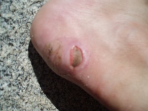
ankle boo boo
Unfortunately, after gaining confidence in the desert, I was leap-frogged by all the Yankees and Pacific Northwesterners in the Sierras. 2006 was a particularly heavy snow year and while I was busy sinking into snow drifts, glissading off the trail, and generally freezing my tooshie off at high elevations, all those winter weather fanatics seemed to easily skate past me on the white mountain slopes. Although I was unhappy at seeing my breath puff up in clouds of white against the cold air, I was taken by the scenery of the snow capped mountains and will always remember tripping over the multiple sun cups because I couldn’t take my eyes off of the jagged untouched scenery.
After surviving the high climbs and cold weather leading up to Tuolumne Meadows, Northern California once again felt dessert-like. It was also a surprisingly remote section of trail and displayed new wildflowers and wildlife everyday. And although gorgeous, I was READY to be in Oregon.

wildflower
While California seemed unending and full of variety, Oregon offered a peaceful dirt path that meandered through still forests. The gentler terrain made it easy to increase my daily mileages and I didn’t think twice about hiking three straight 40-mile days – until I passed-out at the end of the third night – I slowed down after that.
I slowed down to take in the beautiful waters of Crater Lake that are such a deep color of turquoise it looks like a large lake of blue dye, not water. I also slowed down to avoid the massive wildfires that devour portions of the western forests each summer. In some places I was able to hike around the fire zones, but when I arrived at Mount Jefferson I was stopped by a massive plume of smoke that engulfed the trail and 6,000 acres of central Oregon. I decided to skip 60 miles ahead and come back to Oregon after reaching Canada and after the fire had been contained.
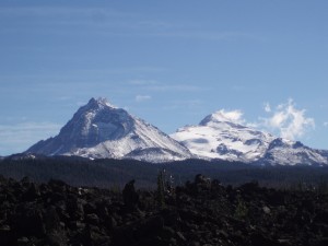
Mount Jefferson
In Washington State the trail was marked with snow covered peaks that stood tall and proud. The trail circumvents Mount Rainier and climbs gently up the slope, but below the summit, of Mount Adams. The trail was rerouted around Glacier Peak because heavy flooding had washed out the bridges on the PCT, but I was told by Scott Williamson (who is the Lance Armstrong of the Pacific Crest Trail) that the PCT was passable. I believed Scott… and I almost died. Amid a three-day downpour of rain, I clung to fallen trees trying to inch across raging rivers and struggled to stay on the unmarked path in dense cloud cover. Granted, I do have some awesome scars from that section of trail, Thanks Scott!
When I finally made it to Canada it was four months from when I started the trail, and I found myself alone, in a cold wet drizzle and crying. I cried partly because I still had to hike several more miles in the rain to reach civilization, but above all I cried because the adventure was over… and I didn’t want it to end.
My four months on the PCT gave me a journey more beautiful and magical than I could have dreamed and afterward I was ready to head back to the cubical – so I could save up for the next adventure!